
When planning a vacation, there are many questions that cross our mind. If it’s a place you’ve never been to, you search it on Google, read up on it and then check Google Maps for the exact location. You may also check out with your friends about how to travel, how much time it takes to reach, etc. This happens to all of us at some point of time and we get all kinds of suggestions and opinions that can sometimes create unnecessary confusion. The answer to all your questions is Google Maps. It has a new feature which gives detailed information on routes, modes of transport and the time taken to reach the place. You can also check out nearby train stations, bus stops and places as well. Using the app makes planning and traveling on your journey much simpler. Here’s how to make the most of it.
Finding the quickest route
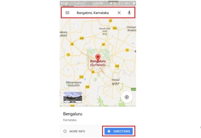
Open Google Maps on your Android or iOS device
Enter name of the place you wish to go and tap on "Directions"
Enter your current location and choose transit modes (For ex. Tap on the train logo)
![]()
You'll get several ways to reach the destination. To make it even easier, click on the "Options" tap, choose your "preferred mode" and "routes"
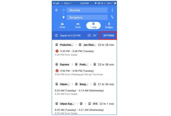
Choose the shortest route and click on the "Start" button

At times, if isn’t possible to take a local transport, Google Maps provides you an option to book an Ola or Uber cab using the same interface. You just need to have OLA or Uber installed on your phone. If you don’t, Google Maps will redirect to Google Play Store from where you’ll be able to download the apps.
Book an Ola or Uber cab within Google Maps
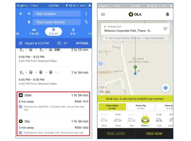
You need to scroll down to the page, select your pickup location and destination and then choose your ride and click on "Confirm Booking" button. You are done with your booking!


